Attribute Data Collection
Remotely positioning features from a safe location is one thing; having the ability to obtain and record additional attributes on assets is a game changer. This turns any GIS professional into a complete data collection rock star! Not only can you provide critical location data, but a complete set of conditional and dimensional information can be collected while you’re on site. The laser can be used to measure existing features during the design phase and then to verify that construction has been properly executed. Store an image with your data and you’ve got a time-stamped record of the asset.
Measure More Than Just Distance
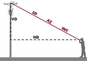
All TruPulse laser models measure slope distance, but they also calculate the vertical distance and horizontal distance depending upon your application or requirement, you can capture the value you need.
Calculate Heights, Depths, and Elevations
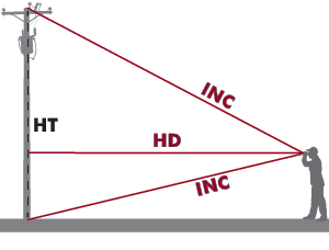
Use the on-board 3-point height routine to measure a height or depth value. Don’t have a clear line of sight to the top or the bottom of your target? No problem – in many cases the TruPulse can still calculate the value you need.
Measure 2D Missing Line
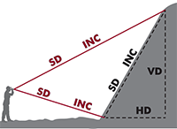
With just 2-shots within the same vertical plane, any of the TruPulse® models can calculate the Slope Distance (SD), the Degree of Inclination (INC), the Vertical (VD) and Horizontal Distance (HD) between those two remote points. Inclination read-outs can be in either degrees or percent slope.
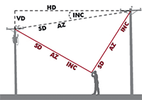 Measure 3D Missing Line Between Any 2 Points
This 2-shot routine can be performed by any of the products that has a compass or encoder. Regardless of what angle you shoot at, simply aim towards any two remote points on a target and get all five measurement values between them.
Recommended Lasers / Data Collection
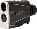 TruPulse® 360°
Makes 3D measurements Using a built-in compass, has 7-power optics with an in-scope data display and achieves up to 20 cm (8 in.) distance accuracy.
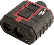 TruPulse® 200X
Makes 3D measurements when paired with the MapStar® TruAngle®, has 7-power optics with LED display and achieves 4 cm (1.6 in.) distance accuracy.
 LaserSoft® Measure App
Available for both Android and iOS, this free app from LTI allows you to collect, store and save raw measurements from your
TruPulse laser.
Download it for free! Search “LaserSoft Measure App” or click on the icons below!
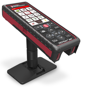 TruPoint™ 300
Makes 3D, cm-level measurements using built-in encoders and has a red-dot for aiming at short range and a 4-power camera for long range.
 LaserSoft® CORe App
Available for both Android and iOS, this free app from LTI allows you to collect, save and transfer raw measurements from your TruPoint 300 laser.
Download it for free! Search “LaserSoft CORe App” or click on the icons below!
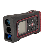 TruPoint™ 200h
With Hybrid Measurement Technology (HMT) – the world’s first laser to provide accurate long-range outdoor measurements plus short-range high-accuracy indoor measurements. Ensures targeting in every situation with a bright HUD LED display.
