GPS/GNSS TruPulse Laser Mapping
GPS/GNSS antennas are designed to receive specific signals: the receiver computes the position or location and compels you to physically occupy the feature or asset you need to map. What happens when your satellite signal is impaired? Or what if your asset is centered in a dangerous area, like the middle of a street? What if you don’t have the time to stand next to every feature you need to map? Integrating Laser Tech’s TruPulse laser rangefinders means there are no limits on the assets you can map!

Map More. Move Less.
The most highly valued benefit of laser mapping is having the ability to occupy a single, convenient, and safe location with the freedom to map as many assets as you can see. When you use your high-accuracy GPS/GNSS device, everything you collect will be based off these precise control points.
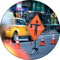
Be Smarter and Safer
Stay out of harm’s way by remotely measuring or positioning features from a safe location. The power of Laser Tech’s reflectorless technology allows you to acquire measurements to practically any surface type or material, at sharp angles, and from long ranges.
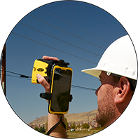
Integrate TruPulse Lasers with Your Current System
As a GIS professional, you’ve likely made hefty investments in your equipment. By creating a seamless integration to practically any system and workflow, integrating a TruPulse laser is easier than you may think! Check out the list of Laser Tech compatible hardware and software solutions.
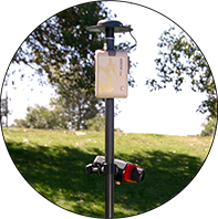
Achieve RTK Accuracy Anywhere
Whether you are using a 3rd party software or LTI’s MapSmart® on Android® solution, GIS professionals can achieve centimeter-level accuracy* on assets located within unfriendly environments such as alleyways, under trees and even in the middle of a busy street.
*GNSS position needs to be RTK level and used with the TruPulse® 200X with or without the MapStar® TruAngle®
Recommended TruPulse Lasers / Data Collection
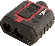 TruPulse® 200X Laser Rangefinder
Measures distance and inclination angle values and when paired with the MapStar® TruAngle®, measuring horizontal angles makes a 3D solution. Achieves 4 cm (1.5 in) distance accuracy.
 ArcGIS® Field Maps
A mobile data collection app that makes it easy to capture accurate asset data. Need to map assets in GNSS-impaired areas? Check out the Eos Positioning + TruPulse solution!
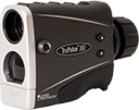 TruPulse® 360° Laser Rangefinder
Makes 3D measurements Using a built-in compass, has 7-power optics with an in-scope data display and achieves up to 20 cm (8 in.) distance accuracy.
MapSmart® for Android®
Easy to use field data collection software designed for anyone who needs to quickly and accurately map and measure anything with the ability to integrate any external GPS/GNSS receiver.
