Trimble® Laser Mapping Integration
Trimble® and Laser Tech have been business partners for years. Their integrated solutions allow customers to collect, manage, and analyze complex information faster and easier. By applying Trimble’s advanced positioning solutions, productivity increases and safety improvements are being realized, especially when LTI lasers are used.
Trimble® Geospatial Mapping Software Solutions
Trimble® provides a variety of software solutions that are pre-integrated with laser offset functions that allow users to collect features and attribute data from one position.
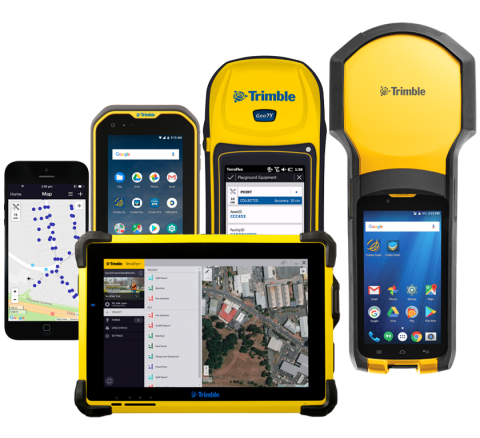
Trimble® TerraFlex™
Trimble® TerraFlex software is a flexible and easy-to-use cloud-based solution for field data collection. The software helps to streamline your GIS data collection and update tasks and delivers high accuracy positioning when you need it. Remote feature capture functionality embedded directly into the TerraFlex app simplifies the offset mapping workflow and enables you to accurately capture features in more places easily and safely.
- NEW: Now supports Capturing Remote features using the TruPulse® series laser rangefinders.
- Users can capture the location of multiple assets from one place for efficient data collection.
- Users can overcome physically inaccessible, hazardous or poor GNSS environments using the TerraFlex software and LTI TruPulse lasers.
- For more information:
- Read more at on the LTI blog or download the white paper
- Watch the webinar presented by GPS World
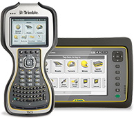
Trimble® Access™ 2020
Trimble® Access is their leading field software for professional surveyors looking to capture accurate RTK positions. The “Measure Laser Points” function can improve worksite efficiency for general surveys and capture offsets from a known location.
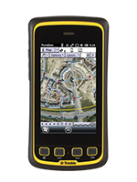
Trimble® TerraSync
When you’re highly productive in the field, you need a highly productive GIS data collection software that’s powerful enough for you. Integrate all the ways you collect data with a GNSS handheld computer and laser rangefinder that was designed for you to collect high-quality features and position data for GIS update and maintenance.
Enhance your workflow efficiency with laser integration that captures accurate measurements and automatically enters attribute data electronically that helps eliminate mistakes.
Laser rangefinders are typically used for GIS data collection for the following situations:
- When mapping the location of an inaccessible object
- When mapping the location of an object that does not get a GPS signal
- When mapping the location of an object that’s GPS position doesn’t have enough accuracy
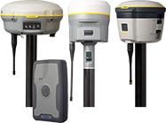
R-Series
Trimble® GNSS solutions were designed with surveyors and GIS workers in mind. Providing both with reliable, innovative GNSS survey and GIS solutions that meet your distinct requirements all while easily acquiring accurate position data faster. All R-Series GNSS receivers can integrate with MapSmart® on Android solution.
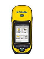
Trimble® Geo 7X
The rugged Trimble® Geo 7X handheld laser-based software solution was designed to make handheld point measurements easier, more efficient, and flexible. It has easy-to-use feature coding and feature-rich graphical COGO routines for calculating points and features. Many Geo 7X users integrate LTI lasers to acquire more data in less time.
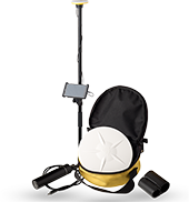
Trimble® Catalyst: Software-based Receiver
Trimble® Catalyst is a small, lightweight antenna that plugs directly into your Android® phone or tablet’s USB port. Once connected, measure, locate, and share the things you map with the world. Catalyst’s revolutionary technology features a software-based GNSS receiver that delivers high accuracy positioning with an on-demand subscription service. This too can integrate with LTI’s MapSmart with Android software.
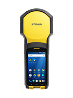
Trimble® TDC150
The Trimble® TDC150 GNSS handheld receiver is built for GIS users who demand maximum productivity and positioning accuracy out on the job. Many TDC150 users integrate LTI lasers to acquire more data in less time utilizing the TerraFlex app.
