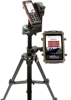
TruPoint® 300
Achieve high accuracy and the measurement functionality of a total station but without the weight, bulky size, and high cost. The TruPoint® 300 laser mapping system is ideal for BIM applications, indoor mapping, general construction, and pole audits.
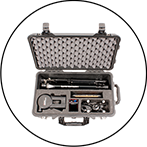
Compact and Portable
The TruPoint® 300 laser mapping system is compact enough to fit entirely in LTI’s pelican case that is aircraft carry-on approved.
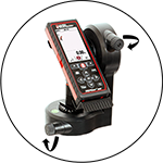
Pinpoint Precision
Combine the TruPoint® 300’s +/- 1 mm distance accuracy with LTI’s Laser Aiming Assist (LAA) for vertical and horizontal fine tuning making your measurements perfectly on point.
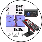
Red-dot or 4X Camera Aiming
The TruPoint® 300 provides red-dot aiming ideal for precise indoor targeting. For environments where the red-dot may not be visible, the built-in 4-power magnification camera can be used.

TruPoint 300™ Laser Specifications
Range Accuracy to Typical Targets: ± 1 mm
Range Limits: 0.05 up to 300 m (0.16 to 1000 ft)
Angle Accuracy: ± 0.1° Horizontal and Vertical
Relative Height Accuracy: ± 1 cm (± 0.5 in.) to targets 30 m (100 ft) away
MapSmart® on Android® Compatibility
Compatible Data Collection
 Free LaserSoft® CORe App
Available for both Android and iOS, this free app from LTI allows you to collect, store and save raw measurements from your TruPoint 300 laser. Download it for free! Search “LaserSoft CORe App” or click on the icons below!


 MapSmart® for Android®
Easy to use field data collection software designed for anyone who needs to quickly and accurately map and measure anything.
 Esri® Survey123 for Collector ArcGIS®
Accurate Data Collection Made Easy. Replace unreliable paper-based data collection with a trustworthy digital solution that fits the needs of diverse environments. TruPoint® 300 measurements can be consumed as text input directly into this app.
 Esri® ArcGIS® Collector
This mobile data collection app makes it easy to capture accurate data and return it to the office. TruPoint 300 measurements can be consumed as text input directly into this app.
